
Maps & Data
Collecting data is not enough.
You must interpret it, visualize it, and share it to make an impact.
Maps & Dashboards
StoryMaps combine the storytelling power of maps with rich narrative and photo and video in a clean user interface for outreach, marketing, and reporting.
ArcGIS StoryMaps
All information about organisms, landscapes, and conservation has a spatial component, and maps help us find meaning in that data.
Mapping and data products are designed alongside my GIS firm Blue Water GIS.
Scroll down to learn more…
Maps & Dashboards
We offer multiple platforms to display map-based information based on your needs.
-
Using ArcGIS Online and ArcGIS Pro, we create custom maps with public or private data to suit your needs. Interactive features are near limitless with the ability to embed into other ArcGIS web apps.
-
These are getting rarer and rarer, but we do have the capability to create maps ready for the printer.
-
Search, filter, visualize, graph, and otherwise explore map-centric data.
ArcGIS Dashboards
ArcGIS Experience Builder
Tableau
The cutting edge of data analysis and sharing lies here.
StoryMaps
-
StoryMaps, an ArcGIS platform, offer modern marketing and communication to the general public when maps and other geospatial elements are critical to the story.
-
A modern, map and data-based approach to the traditional Powerpoint.
-
Many organizations and agencies are not only accepting StoryMaps as a valid format, but are expecting a more engaging way to report findings.
-
Whether for a StoryMap or other outreach, we can provide custom photography services to help tell your story. See portfolio here.
We have been building StoryMaps since they were invented. We have two ESRI StoryMap of the awards, and have designed stories for National Geographic, The Nature Conservancy, and The Wild Bird Trust, among others.


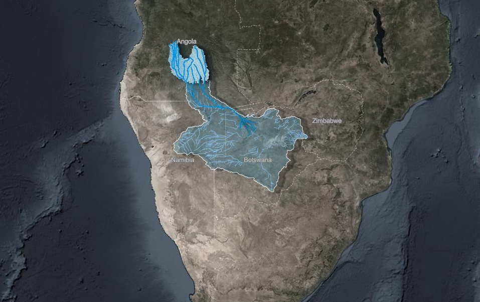
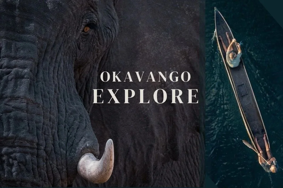
Okavango Explore - National Geographic, Wild Bird Trust, Earthviews (photo courtesy National Geographic)
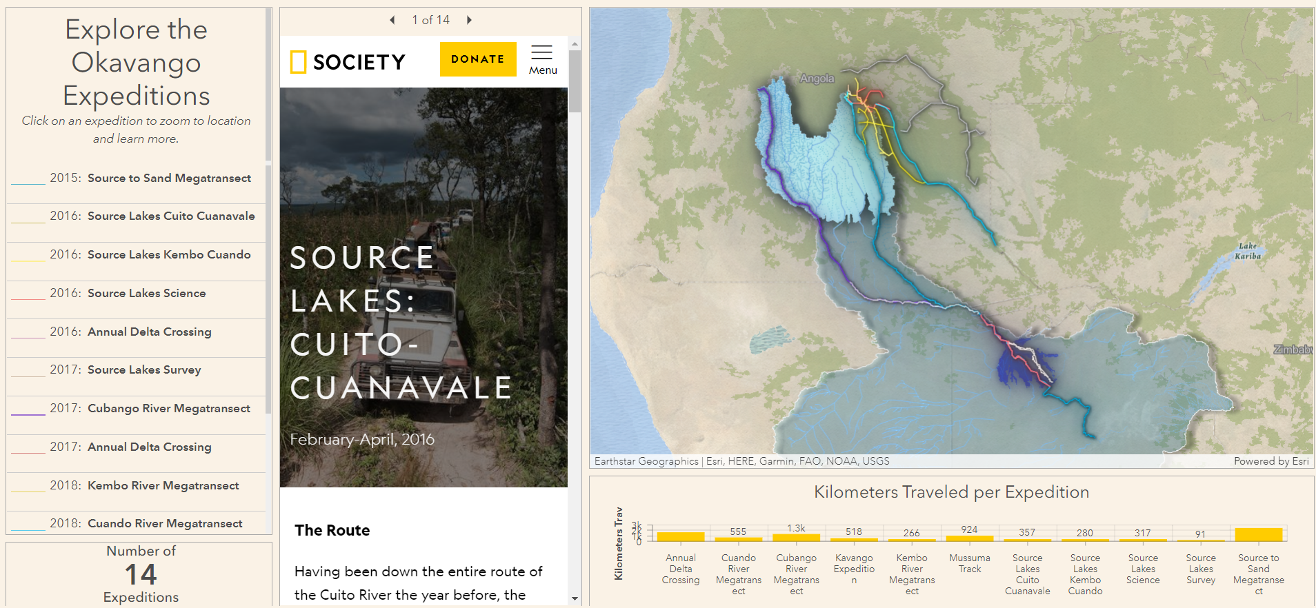
Okavango Explore - National Geographic, Wild Bird Trust, Earthviews
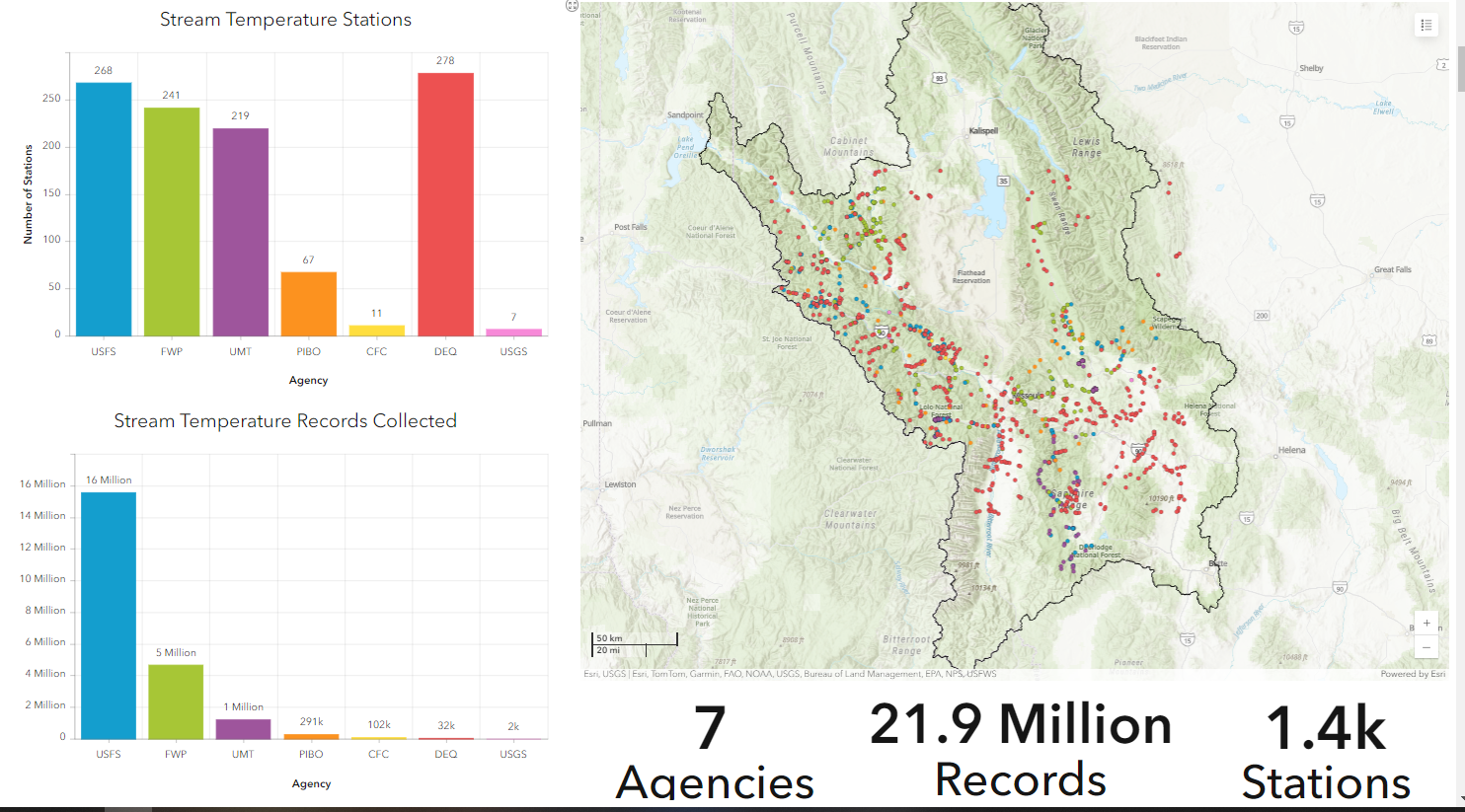
Stream Temperature Monitoring Dashboard - Lolo National Forest
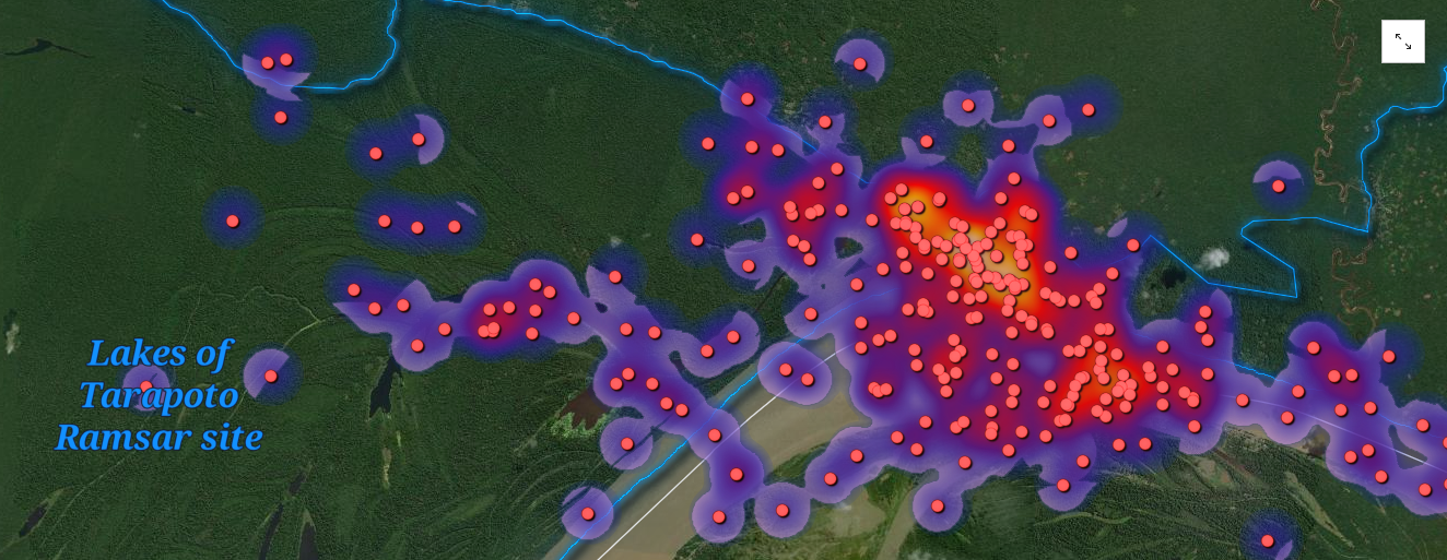
Ambassadors of the Amazon - National Geographic Society, Omacha Foundation
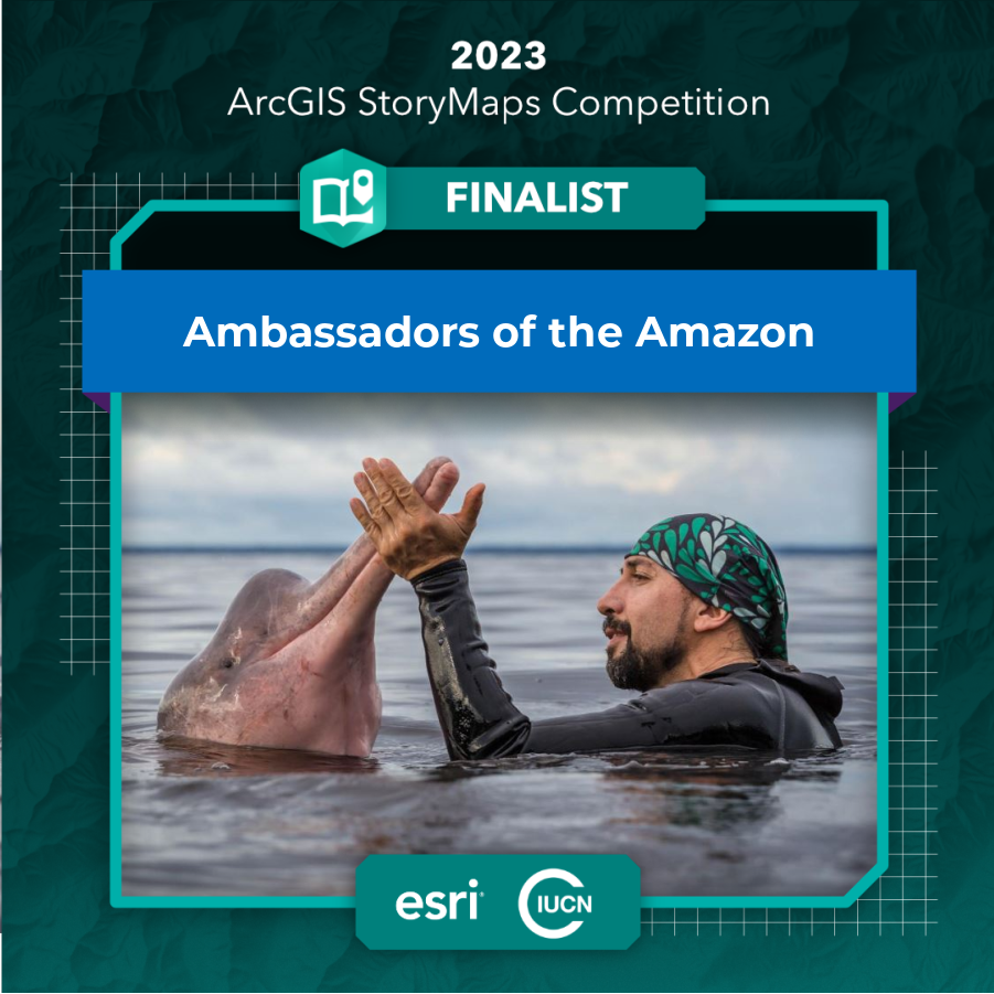
Ambassadors of the Amazon - National Geographic Society, Omacha Foundation (photo courtesy Omacha Foundation)
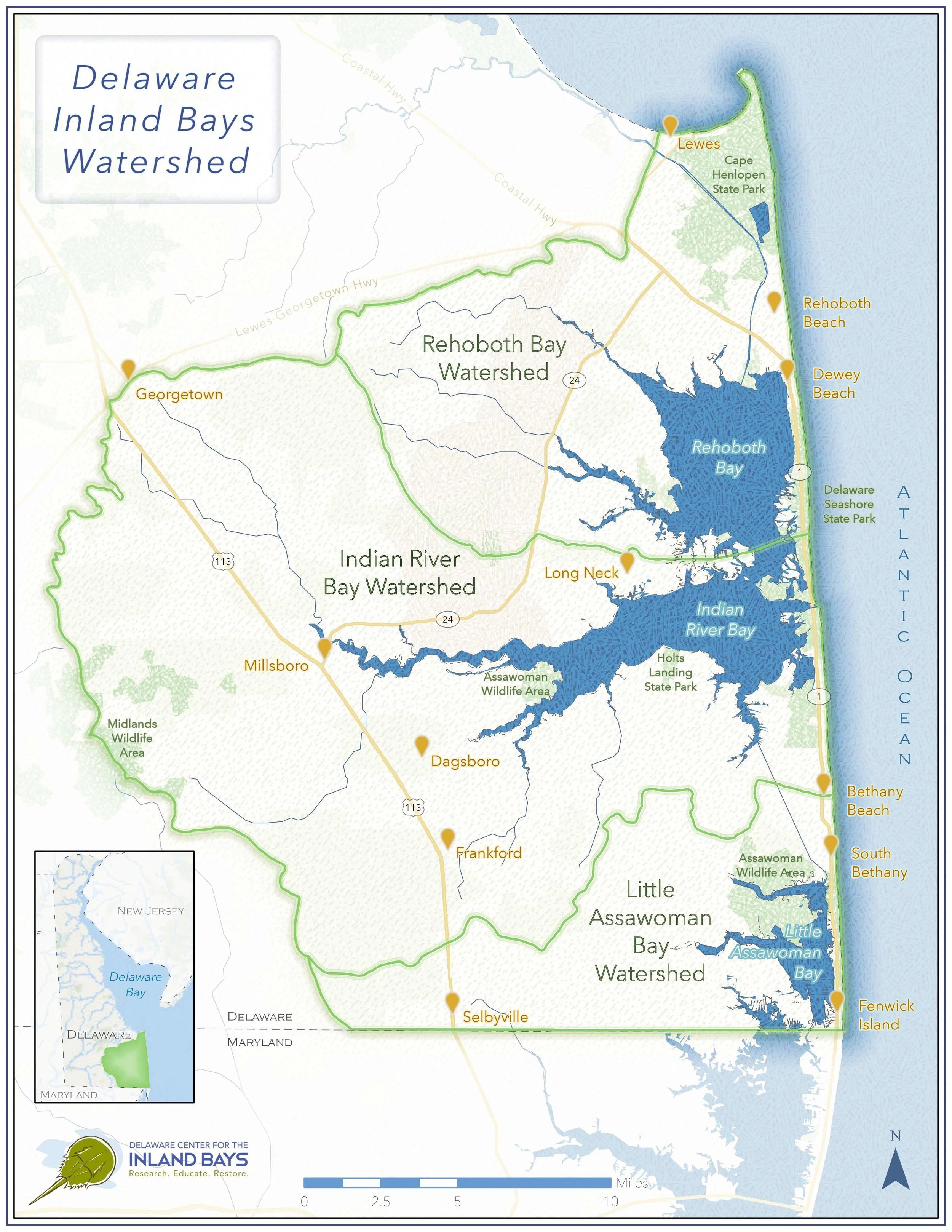
Delaware Center for the Inland Bays
What People Are Saying
-
“Our collaboration with Mark was personable, fun, and easy. Mark not only creates a visually stunning product, but he does something else brilliantly: no matter the complexity of an organization’s history or mission, he's able to build an incredibly clear and engaging narrative to present to the world.”
— Casey McFarland, Executive Director - Tracker Certification North America
-
“Mark is a highly skilled naturalist and a dedicated mentor in the art of wildlife tracking. I wholeheartedly recommend him to anyone seeking to enhance their knowledge about ecology, track & sign, or deepen their understanding about the natural world.”
— Jazmen Yoder, Owner & Outdoor Educator - Northwest Natura
-
“Mark immediately stands out as a kind, professional and approachable person. He has a deep knowledge of tracking and the interconnected relationships of an ecosystem. Mark has a knack to explain hard science in a way anyone can learn from him. He explains and reads the landscape intuitively and I am always impressed by his field skills.”
— Kevin O’Malley, Executive Director - South Sound Nature School